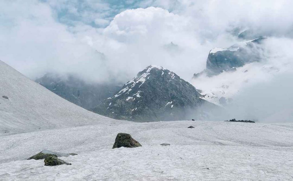
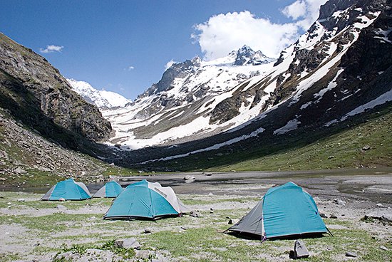
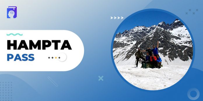
The Hampta Pass in Himachal Pradesh’s Manali area is one of the most iconic hikes. The path is densely forested, has pure glacial valleys, huge meadows, and panoramic scenery.
The area is easy to visit, and the experience of crossing the mountain is just exciting. Unlike most of the treks, this one begins at Manali rather than a rural hamlet. The highlight of the journey and a mesmerizing site is Chandratal, a crystal blue lake located at a high altitude.
How To Reach The Hampta Pass?
You have plenty of options to get to the Hampta Pass.
- Bus: You can take an overnight bus to Manali from Delhi. It takes almost 14 hours to reach Manali. Also, you can reach Manali from Chandigarh, which is a 10 hours journey. Prefer government buses over private ones as they are always more dependable. Whatever bus you choose, make sure you are in Manali by 9-10 a.m. The Manali to Hampta Pass distance by road is 16 km, accomplishable in 30-40 minutes.
- Flight: Flying to Delhi / Chandigarh / Bhuntar Airport / Kullu are the options you have. Manali is only a few hours away and may be reached by bus or private cab.
- Train: You can also arrive by train since Pathankot railway station has direct buses to Manali, which is 300 kilometers away and requires overnight travel. Even in this scenario, plan to arrive in Manali a day ahead of time. Or you may arrive at the Chandigarh Railway station and take a shared cab to Manali.
Ensure that you get in Manali by 10 a.m. on the first day of the itinerary. This will allow you to arrive at the assembly place by noon.
What is the Best time to visit the Hampta Pass?

Between mid-June and mid-October is the perfect time to visit Hamta Pass. There is some snow on the high passes at the start of the season, but it dissipates completely by August. Although rain is common during storms in the Kullu-Manali valley, it will be sunny in Spiti.
The temperature will most likely remain between 12 and 20°C throughout the day, while the temperature in most altitude camping locations will be between – 2 and 6°C in the evening. A little snowfall is possible in the last months of the travelling season (Sep – mid-Oct). During the day, temperatures will range from 12 to 15°C.
Suggested Itinerary

How you start and end is up to you, but here are some phases scheduled to give you an idea. You can plan your Hampta Pass trek accordingly to make the most out of it.
1. Manali To Chikha Through Jobra
The road journey consists of around forty hairpin curves that are traversed in less than an hour. Jobra has all the essentials that you require for a comfortable trek. On the first day, you will begin your trip from Jobra at an altitude of 9,800 ft and go to 10,400 ft in around 2 to 3 hours. The hike itself begins with the Allain Guhugal Hydel Project intersection.
Cross the main road and take the tiny track that takes you into the nearby pine forest. The route is bordered by trees of many species, including deodar, maple, oaks, spruce, and oaks. After a twenty-minute hike, you will come to a bend that overlooks a lush field dotted with pebbles. The Rani Nallah, which runs straight into the meadow, may be seen from here.
If you’re simply looking for adventure, you may bypass the meadow and hike up the hill, which will take you to Chika. Finally, you’ve arrived at a large, open green space with the Rani River running through it. That’s ideal for erecting tents and spending the night.
2. Chika to Balu Ka Ghera
The next stop is Balu Ka Gera. You might fail to see it from the campground. Begin your journey down the river’s left bank, which leads to a slope of rocks and uneven ground. The route is easy to walk on and won’t take much to reach your next destination. The entire land along the river’s right bank is bordered by lovely Rhododendron trees. They dominate the lower and center areas, while the higher section is lined with clusters of silver birch.
When the path through the silver birch trees comes to an end, turn around and take in the magnificent vista of the snow-capped peaks of Dhauladhar. This will leave you speechless. A stream waterfall is on the far left where you can refill your water bottles for the rest of the journey.
After crossing the waterfall, go to the river on your left. You may, however, cross the rivulet to get to the other edge. The water is icy cold, but you can jump from one rock to another to cross the stream. Almost one-half of your day’s journey gets completed as you get to Jwara. It’s a lovely valley featuring snow-covered cliffs on one side and a river on the other. This is a spot where you may experience Mother Nature at her finest.
The mountains in front are snow-covered, and Hampta Pass is located behind them. The route continues along the river’s edge, eventually leading to a rectangular valley. The path is strewn with brilliant hues of flowers while the trees fade from view. After a half-hour hike, you will reach the valley’s end, which serves as Jwara’s fishing grounds.
The route grows steeper and is covered with pebbles and snow from here on. The path concludes in Balu Ka Gera. It’s a beautiful campground surrounded by mountains that may be crossed to go to the pass. The place is at a height of 11,900 feet above sea level.
3. Balu ka Ghera to Siagoru
The third day of the journey lasts 9 hours and is divided into two parts:
- A steady ascent to Hampta Pass on a moderately high slope
- A rapid descent to Sia Goru
It’s the day when you are going to conquer the highest point of the journey, 14,100 feet. The trip begins by moving towards the mountains while staying alongside the river. The scenery is gorgeous, with small orange and yellow flowers were strewn throughout. This route will take you to the foot of the ascent to the Hampta Pass. After hiking for an hour, you will get to the first plateau.
During the summer, the area is covered with fresh snow, while the rest of the year, there are just patches of snow. The Deo Tibet peak may be seen just ahead of you. You’ll soon arrive at another plateau, followed by a ridge. After another 30 minutes of trekking, you’ll reach the ridge’s terminus. Continue along the route to the second crest; Hampta Pass is only a few meters and a curve away.
From here, a 15-minute steep, difficult climb leads to the Hampta Pass. The ascent is both exhausting and thrilling, but the breathtaking vista that awaits you ahead will make up for the effort. Spend some time there enjoying nature’s bounty before descending to the next site, Sia Goru. The descent to the pass is now followed by another quirky descent.
The slope is so steep that even the mountain’s base is hidden. The easiest method to go down is to either slide down the hill or use the rope as support. By this time, Spiti will be seen as the road gets more meandering. It will take around one and a half hours to reach the bottom of the valley that leads to Sia Goru.
The rest of the journey involves a flat terrain and, hence, is quite easy. The Sia Goru campground is also located along the riverbank. It is now time to pitch your tents and call it a day.
4. Siagoru to Chatru, Drive to Chandratal
The penultimate day’s journey starts from Sia Goru (12,900 ft) and the destination for the day is Chatru (11,000 ft). The gentle downhill track will take around 5 hours to complete. Walking across the river valley and hilly terrain feels pleasant. The mountains are desolate and devoid of any flora whatsoever.
Chatru can also be found a short distance away. The difficult portion is about to follow now. The route may occasionally lead to mountain ridges and edges and includes treacherous paths. However, the journey is not as arduous as it appears. You’ll love the exciting mounting and sliding down the course.
5. Manali to Chatru / Chandratal
If the weather and roads permit, you can climb up to Chandratal Lake, also known as the Moon Lake, on the fifth day of your journey. You will be enchanted by the pure blue lake. The lake is around 7 kilometers from the Chatru campground and only a few hours from the Chandratal campsite.
You may also hire a car from Manali to reach the lake from the campsite and back. It will take approximately 7 hours for trekking. The lake, however, is only open during the summer.
Additional Tips
Here’re a few tips for a safe and comfortable journey into the Hampta Valley Manali.
Your Clothing should include:
- A woolen scarf, woolen gloves and woolen cap
- 2 pairs of pants
- 3-4 T-shirts with long sleeves
- 2 Shirts with long sleeves
- 2 pairs of thermals
- Wind-proof jacket (Ensure this is not just a windcheater.)
- 3 pairs of socks
- 1-2 pairs of woolen socks
You need a certain amount of physical fitness due to the lowering of oxygen levels with higher altitudes.
- 1 hour of practice every day is recommended to stay physically prepared.
- Begin with 5 minutes of nonstop running and gradually increase.
- Add 3 sets of 8-10 squats to the mix.
- Use as many steps as you can with a rucksack weighing 10-12 kg (excellent if 15 kg).
- Before embarking on the journey, you should be able to accomplish a 10 km walk in 90 minutes or a 4.5 km jog in 25 minutes on flat terrain.
Carry all your essentials, such as cold cream, rain cover, trekking shoes, sunglasses, extra cotton bags, etc.
Despite the ease of trekking it offers, Hampta Pass has unpredictable and challenging weather. Thus, going with a guide is always the best option, even if it’s your repeat trip.
Food

North Indian cuisine is offered along the journey to the Hampta Pass. Breakfast and supper are substantial, but lunch is light. To modify your body, try adjusting to this type of meal cycle for a month.
Intriguing Facts
- The Hampta Pass trek distance is about 35 km, starting from the basecamp in Manali. The trek takes you to a maximum height of 14,100 feet.
- This route is regularly utilized by shepherds from the lower Himalayan region seeking high altitude pastures during summers, as Lahaul’s cold desert is barren.
- The name of this trip comes from Hamta Village, which is located on the path to the pass. The Hampta Pass connects Lahaul’s Chandra Valley with the Kullu Valley.
- Walking through a snow pass and across a snow bridge is a unique experience. You may have experienced snowfall and walking on snow before. However, here you’re walking directly on top of a stream, which is covered by an unevenly thick sheet of ice. And, the water flowing down beneath your feet is audible. A false step is enough to get your feet stuck into the icy water. Many similar holes may be found on the snow bridge, caused by different travelers who took the wrong step.
Conclusion
The Hampta Pass is a journey into the lap of the Himalayas. It’s a 4-5 day adventure with loads of thrill. Hampta Pass is a crosscut trip that begins in the lively Kullu and ends amidst the arid Spiti valley. Regarding the difficulty level, anyone above 14 without a heart problem can trek alone or with companions. And, this article was to make your trekking even more wonderful.
People are also reading:


